Norfork Schools
celebrates

10K Day
Ten Thousand GLOBE Measurements Day
Norfork Schools
celebrates
10K Day
Ten Thousand GLOBE Measurements Day
(NORFORK, Arkansas) Another major GLOBE milestone was reached today. Students from the elementary school reported the 10,000th measurement since they started participating in the GLOBE Program. Yesterday's Student Weather Recorders were Tabitha Ellis and Yolanda Flick, who jointly entered the 10,000th measurement into the GLOBE database, just before they went to their scheduled activity period.
|
|
|
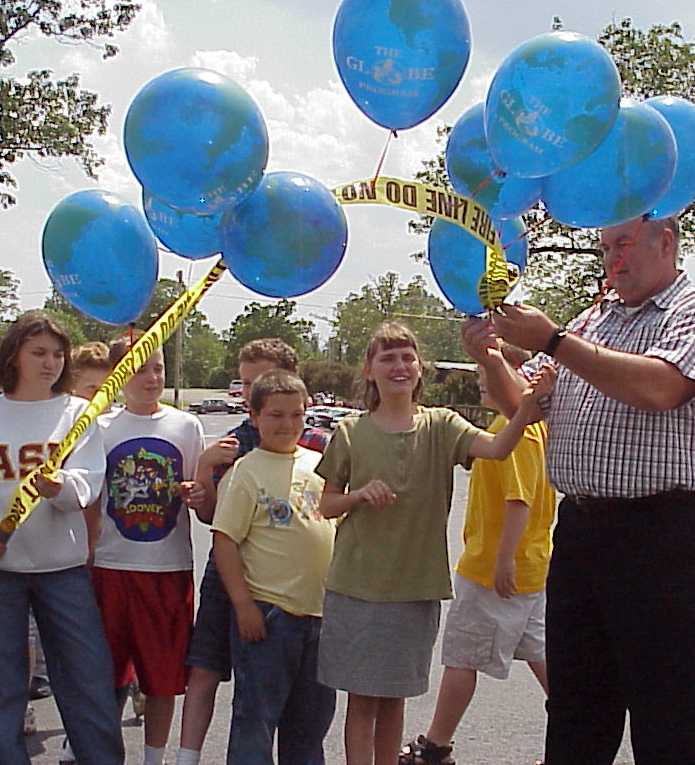
Some of Mr. Geery's fifth grade science class students celebrate their efforts as participants in the GLOBE (Global Learning by Observations to Benefit the Environment) Program by preparing to launch the special balloons. |
History
Our school's first measurements were taken on 17 August 1999, following installation of the weather station and precipitation gauge. At this same time, a Global Positioning Satellite (GPS) receiver was used to record the latitude and longitude of each potential study site. The following week the first surface water measurements were made at Jordan Marina on Lake Norfork. During the next month additional surface water sites were initiated at the mouth of the North Fork of the White River and at the Norfork Village Ferry Landing on the White River. Simultaneously, students collected a core sample of the soil at the weather station and performed a classification and particle distribution analysis of each horizon in the profile. Additionally, a river bottom land soil sample was taken from a field near the river and analyzed in the same fashion. Finally, during the month of October, weekly soil temperature measurements at two depths were started at the weather station site.
Today, Norfork students have measured and reported data daily from the school location for two school years and the summer inbetween. In addition to surface water sites cited above, two new sites were started this school year on Big Creek and Morton Creek. Soil moisture data has been reported monthly for over a year and weekly soil temperature data has been reported every week except one since it began in October 1999. A series of graphs generated by the GLOBE visualization software is available for easy access at the link illustrated.
Bud burst data has been reported for the past two springs. This documents the sprouting of leaves on a least two species of deciduous trees that live on school property. Finally, Land Cover measurements have been made for four local sites.
The actual tabulation of measurement totals to date can be accessed here for your information.
Celebration Activities
|
|
|
Last minute untangling of a knot before launch. |
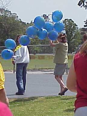
Activities that were observed on this special date varied by class. A special helium-filled chain of balloons was launched with a message in a capsule. Each balloon represented a thousand measurements and the ten foot plastic tape, the record established by the total range of the measurements. Due to the gusty wind conditions, some untangling of the balloons was required.
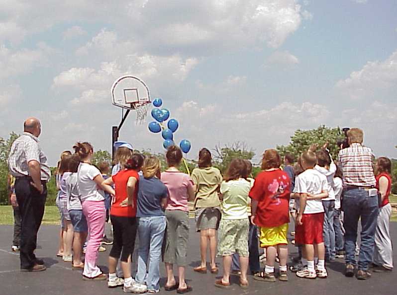
When a lull in the winds presented itself, the balloons were launched. Despite their near neutral buoyancy in the air and the drafts that were encountered, the launch was successful. The balloons dodged the basketball goal, skidded across the merry-go-round, and lifted just over the treeline to the north. They disappeared into the valley, possibly caught in a down-draft, and for a few minutes their flight duration was in serious question. Then, way off in the distance, the balloons re-appeared sailing higher into the blustery spring sky.
Time will tell if the message in a self-addressed stamped envelope is ever found and returned.
|
|
|
The balloons just skirt the basketball goal on their way out yonder! |
Future Events
Students will expand biological observations from the adjacent land areas surrounding the school. Trails have been marked through the woods surrounding the school and an outdoor classroom is in the works. Students will measure ground cover, canopy coverage, biometric measurements of tree diameter, tree height, species identification and many other biological or botanical data. Furthermore, the data collected by our students will be used in high school EAST Program to develop a map of the study sites. Anyone can access Norfork's data by simply accessing the GLOBE data archives at the GLOBE Web Site. Additionally, our school is sponsoring a GLOBE Hydro-thon of the White River called the NES Ozarks Hydro-thon. Participating area schools can measure and monitor water quality all the way down stream (or at least as far as we can get participants). Would you like to know what is happening to our water? Don't you wish everyone wanted to get involved? Just "Do It". We are looking for a few more good schools. As you can see, our learning journey is charging forward....